top of page

Canterbury
The Mackenzie | Aoraki Mt Cook National Park | Kaikoura | Tekapo | Arthurs Pass
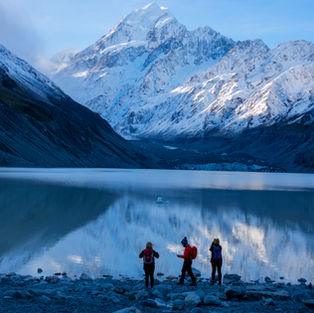
The Canterbury region covers a large swath of the central South Island, from the Pacific Coast to the Southern Alps. Here, you’ll find the country’s largest expanse of plains and some of its most rugged mountains, along with spectacular volcanic, geothermal, coastal, and agricultural regions. This diverse geography makes it a mecca for photographers. Discover the NZ's highest mountains, longest glaciers, vivid turquoise lakes, golden grasslands, stunning coastlines and dazzling starry skies.
POPULAR PHOTOGRAPHY LOCATIONS IN CANTERBURY THAT WE TAKE TOURS
GETTING THERE
AORAKI MACKENZIE INTERNATIONAL DARK SKY RESERVE
The Mackenzie region is situated in the centre of New Zealand’s South Island. Superbly located, the region is just 2.5 hours drive south of Christchurch International Airport and approximately 2.5 hours drive north of Queenstown International Airport.
Domestic airports can be found at Dunedin and Invercargill.
Dark Sky Reserve
The Mackenzie Basin is home the world’s largest dark sky reserve, the Aoraki Mackenzie Dark Sky Reserve. The 4300sq km area includes the stunning Aoraki Mt Cook National Park and the villages of Tekapo, Twizel and Mt Cook.People travel from all over the world to see the Magellanic Clouds, satellite galaxies and the Milky Way, all year round. What’s more, it is possible to see the Aurora Australis, a.k.a the Southern Lights, from this reserve. The Mackenzie Basin is almost free of light pollution thanks to a lighting ordinance in the Mackenzie District Plan where lighting controls have been put in place throughout most of the reserve since 1981.
bottom of page


